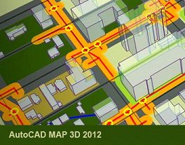
Our AutoCAD Map 2012 training dvd will show you how to effectively use this software in your daily tasks. Our video based instructor led training dvd for AutoCAD Map 3D 2012 will teach you to plan and manage model-based infrastructure and access CAD and GIS data. Lessons and demonstrations include beginner, intermediate and advanced concepts on surveys, topologies, coordinate systems, queries, source drawings and much more.
With over 13 hours of instructor led training, our training for this mapping software will provide you the skills needed to work effectively with this robust program, so you can apply regional and discipline-specific standards to help improve data quality, support productivity, and better manage infrastructure assets. Beginning with an overview of the MAP 3D user interface, and ending with a review of Map Books, this training tutorial will help you work with spatial data more efficiently.
AutoCAD MAP 3D 2012 Training Tutorial outline
Getting Started
Overview
Workspaces
The Task Pane
Drawing Cleanup
Overview of Drawing Cleanup
Select Objects to Clean up
Cleanup Actions Explained
Cleanup Actions
Cleanup Methods
Select and Review Error Markers
Attribute Data
Object Data
Attaching a Database
Introduction to Data View
Create a Link Template
Generate Links to Enclosed
Blocks
Select Objects Linked to
Enclosed Blocks
Create an Object Data Table
Modify an Object Data Table
Attaching Object Data Records
View and Edit Object Data
Generate Object Data Links
Overview of External Database
Links
Advanced Data View
Choosing the Storage Method
Coordinate Systems
Coordinate Systems Overview
Assigning and Verifying
Coordinate Systems
Tracking Coordinates
Geodetic Distance
Importing
Overview of Importing
Importing Lines
Multiple Coordinate Systems
Import Points
Import Attribute Data as
Object Data
Import Attribute Data to Linked Database Data
Exporting
Overview of Exporting
Exporting Lines
Exporting Closed Polylines with Object Data
Export to SDF
Source Drawings
Overview of Source Drawings
Create a Drive Alias
Attaching Source Drawings
Quick View Source Drawings
Deactivating and Detaching Source Drawings
Queries
Overview of Queries
Introduction to Queries
Simple Location Queries
Simple Property Query
Simple Data Query
Simple SQL Query
Compound Query
Query Library
Report Query
Alter Properties Query
Coordinate Transformations
Create a New Drawing from
Source Drawings
Save-Back
Overview of Save-Back
Saving Edits Back to Source
Drawings
Raster Images
Overview of Raster Images
Inserting a Raster Image
Working with Images
Hide and Unload a Raster Image
Delete an Image
Object Classification
Overview of Object Classification
Create an Object Class Definition File
Define Object Classes
Classify Objects
Create an Object Class Object
Annotation
Overview of Annotation
Define an Annotation Template
Insert Annotations
Edit an Annotation Template, and Update
Compound Annotations
COGO
Overview of COGO
Inquiry Objects
COGO Input
Survey
Overview of Survey
Creating a Survey Datastore and Project
Importing Points
Using COGO Tools to Create Points
Topologies
Overview of Topologies
Overview of Network Topology
Create a Network Topology
Work with Topology Objects
Overview of Topology Analysis
Run a Shortest Path Trace
Effects of Flow Direction and Resistance
Run a Best Route Analysis
Run a Flood Trace Analysis
Overview of Polygon Topology
Create a Polygon Topology
Overview of Polygon Topology Analysis
Create a Topology Based on an Analysis
Create Buffer
Topology Overlay
Connecting to Feature Sources
Overview of Connecting to Feature Sources
Overview of Features
Connect to an SHP Data Store
Connect to an SDF Data Store
Overview of Point Geometry
Create System DSN
Connect to an ODBC Database
Connect to a Raster Image File
Connect to a DEM File
Viewing Features
Working with Feature Sources
Set Feature Layer Draw Order and Draping
Using the Data Table
Create a Filter
Create a Query
Query to Add Features
Data Validation
Feature Styles
Stylize Polygon Features
Stylize Line Features
Stylize Point Features
Label Features
Add Zoom Scales
Create Thematic Rules
Create a Thematic Map
Stylize a Raster-Based Surface
Create and Edit Features
Overview of Editing Features
Edit Feature Attributes
Edit Feature Geometry
Create New Features
Create Features from
Geometry
Delete a Feature
Split and Merge Features
Overview of Split and Merge Features
Set Split Rules
Split Features
Set Merge Rules
Merge Features
Point Clouds
Overview of Point Clouds
Connect to a Point Cloud
Stylize a Point Cloud
Create a Surface from a Point
Cloud
Map Books
Overview of Map Books
Anatomy of a Map Book
Template
Generate a Map Book Part 1
Generate a Map Book Part 2
Generate a Map Book Part 3
Navigating the Map Book
|